Weather: forecast was for squally hail showers with bright intervals; reality was a prolonged spell of hail / snow and gale force winds. There was the odd bright spell
Where: Skiddaw, North Lakes
 |
| Long Side Edge with Derwent Water Below
I enjoyed dinner with good friends Alan & Mim Rainford on Friday evening. That was after a day in the fells with Glyn & before a visit to Caldbeck for an "Evening with Chris Bonington" at the Village Hall. Driving towards Caldbeck that night the Northern Fells, looking south, were magnificent: snow capped Skiddaw with all its lightly dusted subsidiaries shining in bright sunshine against a clear blue sky. What a contrast to a few hours earlier!
It was great to catch up with Alan & Mim!
Ferg, Graham, Greg, Alan & myself then took our place in, a packed to capacity, Caldbeck Village Hall as Sir Chris told his life story as a fund raiser in aid of Fell View school. There was a strong community feel to it - it was good!
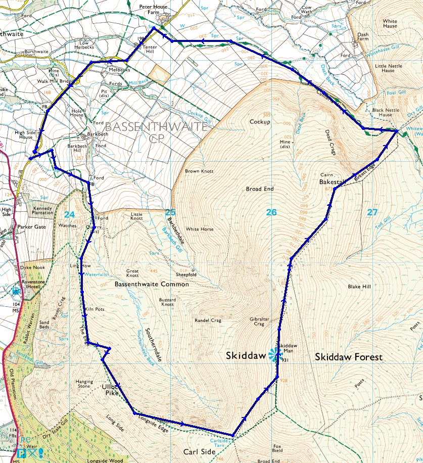
Earlier in the day Glyn & I set off over Ullock Pike to complete this Northern Fells classic ascent of Skiddaw. Skiddaw is a mountain that gets a little bad press, I can understand why folk are un-impressed with the long slog out of Keswick from the south. However, approached via Ullock Pike; Long Side Edge; & Carl Side with the final ascent from Carl Side Tarn to the summit - which is a summit fitting of any of the lake District's 3,000' mountains - it really is a very good day out.
Glyn on Ullock Pike Summit

The weather was promising, initially. However, just before reaching Ullock Pike summit we were hit by the day's first hail filled squall & a full outer shell was quickly put into place by both of us. This is an interesting route since after a good pull up to Ullock Pike the ridge flattens out for a considerable distance over Long Side Edge and around to Carl Side Tarn before another increase in gradient up on to the summit ridge. It was as we began to ascend the final rocky stretch that the wind quickened quite suddenly & a considerably blacker vista developed to the West. Looking back a couple that we passed on the incline made the decision to turn round and head down. Over the last 50m or so of the ascent we noticed that what little fauna there was was encapsulated in ice and the air had taken on a distinctly chill feel. Stepping on to the summit ridge the hail started again: accelerated now by the increased wind it had a sting in it! Within minutes the hail had turned to snow which was beginning to stick and lie; the wind was now strong enough to be blowing us sideways across the rocky summit - there was suddenly a very wild feel to the day, winter had briefly returned with a vengeance.
We hunkered down for just a few minutes behind the summit shelter - it wasn't the place or time to eat - an adjustment of clothing and a quick photo saw us on our way.
 |

As we began to descend off the northern end of the summit ridge, still experiencing the full fury of the snow storm we bumped into a lady called Helen. She was dis-orientated. Having ascended earlier by the same route as ourselves she had become confused when leaving the ridge and was trying to re-trace her steps & descend via the route she had come up by. Since her plan was to end at the Orthwaite Road she opted to join us for the descent. The weather did not relent for some time, it would be interesting to know what constitutes a shower versus a spell of persistent precipitation in meteorological jargon.The snow was lying well down Birkett Edge and it was Dash Falls before we were able to see very much again.
After leaving, the impressive, Dash Falls its a bit of a trudge out this way. We did speculate about a descent of Randel Crag & Buzzard Knott to regain Southerndale, I'll come back and have a look at this in better weather.
Winter over?
Approx 8 miles & 2,950' ascent
No comments:
Post a Comment